


3D Laser Scanning – a reality capture technology
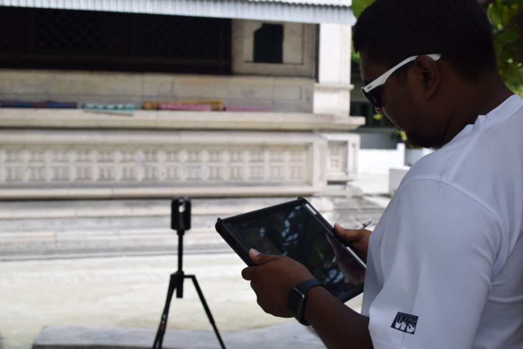
Water Solutions (WS) – the specialists in environmental consultancy and surveying, fascinate us with the selection of their refined tools. These are the contributors to the advanced solutions to their esteemed clients in the Maldives and abroad.
Let’s review 3D Laser Scanning carefully to understand its functioning?
WHAT IS LASER SCANNING?
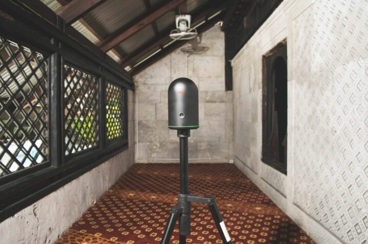
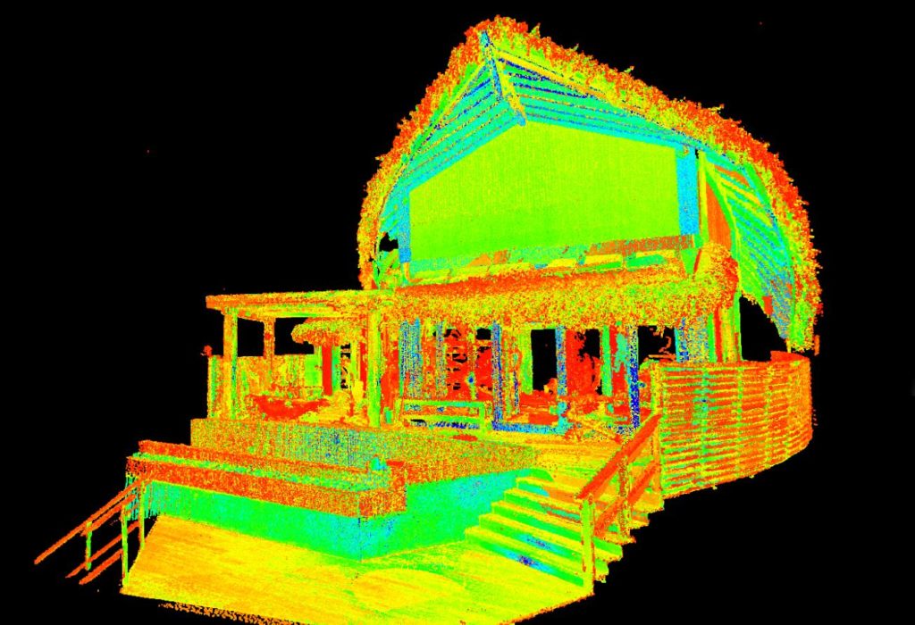
3D Laser Scanning is a non-contact, non-destructive technology that digitally captures the shape of physical objects using a line of laser light. 3D laser scanners create “point clouds” of data from the surface of an object. In other words, 3D laser scanning is a way to capture a physical object’s exact size and shape into the world as a digital 3-dimensional representation. 3D laser scanners measure fine details and capture free-form shapes to quickly generate highly accurate point clouds. 3D laser scanning is ideally suited to the measurement and inspection of contoured surfaces and complex geometries which require massive amounts of data for their accurate description and where doing this is impractical with the use of traditional measurement methods or a touch probe.
This versatile tool can be applied to a multitude of surveying challenges. The application of laser scanning includes:
- Topographical land surveys showing building footprints, levels, surface features, trees etc.
- Detailed building elevation drawings, floor plans, sections, internal and street scene elevations.
- Mapping of utilities including power lines newly laid cabling and piping. Accurate modelling of machinery, for example, factory plant, ducting and for the oil/gas industry.
- Engineering excavation models of landfill, mines and quarries for volume calculation.
- Recording archaeological artefacts and features.
- Archiving for historical records in the event of a fire or other incident.
- Crime scene investigation and forensics.
- Business Information Modeling (BIM) using a laser scanner to avoid spatial conflicts when installing new plant systems to old buildings.
- Coastal monitoring, capturing beach recessions over time, slope stability and beach profile changes.
- Roads and highway surveying with minimal traffic management required. Accurate mapping of tree canopies, girth and crown heights.
- Deformation surveys of buildings, bridges, power stations, refineries, dams etc.
- 3D visualization and modelling.
- Volume and Quantity Surveying

The determined management and dedicated team members at WS ensure their clients receive accurate data and outstanding services. Combined with modern technology and expertise knowledge, the team achieves this goal smoothly.